Here is a nuanced, informative discussion of the looming 2015 El Niño from NASA’s Jet Propulsion Laboratory . . .
El Niño: An unusually warm pool of water off the west coast of South America, usually arriving around Christmas time, linked with complex, large-scale interactions between the atmosphere and ocean in the Pacific.
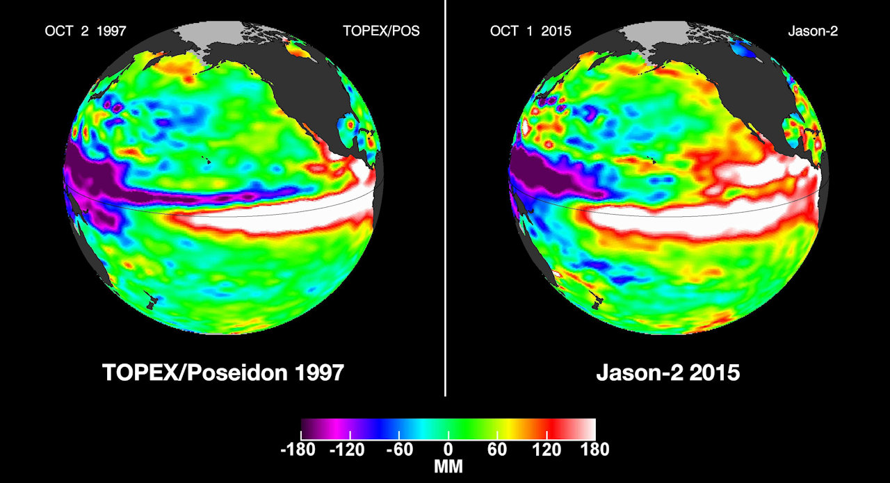
If you live anywhere El Niño has important impacts, you’ve heard forecasters say this year’s event looks just like the monster El Niño of 1997-98. NASA satellite images of the Pacific Ocean in November 1997 and November 2015 show almost identical, large pools of warm water in the eastern equatorial Pacific. The National Weather Service has forecast that impacts this winter will resemble those in 1997, when California and the South suffered floods, mudslides and tornadoes, while residents of the Upper Midwest saved $2 billion to $7 billion in heating costs throughout their unusually warm winter.
When it comes to El Niños, however, there are no identical twins. This year’s event hasn’t always resembled the ’97 one. Satellite observations from early ’97 and early ’15 show conditions in the Pacific Ocean that were, well, oceans apart.
