In case you missed it . . .
Flathead County applied for funding, which they more or may not get, to pay for a study on whether or not the lower North Fork Road could be paved.
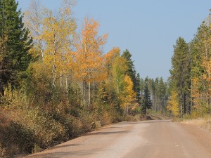
Heading north out of Columbia Falls towards the North Fork corridor along the Flathead River is one of the most scenic, enjoyable drives in Northwest Montana, that is, until just after mile post 12, where the pavement ends. Then drivers and passengers are subjected to a slow, teeth-rattling and dusty ride in order to access two popular entrances to Glacier National Park, more than 100,000 acres of national forest land and the Wild and Scenic North Fork Flathead River.
That may change in the next few years, however, as Flathead County recently applied for a nearly $6 million Federal Lands Access Program (FLAP) grant to begin the preliminary environmental evaluation and public involvement process looking at the feasibility of paving 10 miles of the North Fork Road to the intersection of Camas Road. The funding would also cover roughly two-and-a-half miles of road improvements as a first phase of the full corridor improvement project.
The North Fork Road (NFR) stretches from the north end of Columbia Falls to the Canadian border, passing from state to county jurisdiction just past mile post 12, where it transitions from pavement to a gravel road. Other than a brief half-mile of pavement, there is a 10-mile stretch of dirt road until the intersection with Camas Road, a turnoff that leads to Glacier National Park.