Here’s an interesting find by the guy who operates the Twisted Sifter blog . . .
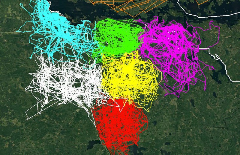
In a recent post by the Voyageurs Wolf Project, they demonstrate how territorial wolf packs are through the mapping of 68,000 individual GPS locations from 7 wolves in different packs from the summer of 2018. They explain:
‘Each wolf’s collar took locations every 20 min (with the exception of the northernmost pack which took locations every 4 hr starting in October) for the duration of the summer. The last photo of the post shows the name and territory of each pack. There are a few packs that we have had collared in the past 2 years that we were not able to get GPS-collars on this year.’
‘This detailed GPS-data is incredibly valuable for understanding pack boundaries and also for our predation research. We visited every spot these wolves spent more than 20 minutes to determine if the wolves made a kill. This required an estimated 5,000 miles of hiking this past summer from our field crew!’